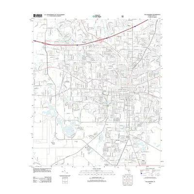
2012 Map of Tallahassee
USGS Topo · Published 2012About this map
Educational institutions and historic grounds define this capital city landscape, where the sprawling campuses of Florida State University and Florida A and M University sit at the heart of the urban grid. The map reveals a city shaped by its academic and civic history, from the Old City Cem near the downtown core to the specialized grounds of University High School. Notable athletic landmarks like Doak S. Campbell Stadium and Bragg Stadium emphasize the cultural weight of these universities in the local community.
Find a feature on this map
38 named features on this map. Tap any name to fly to it.
Don’t see what you’re looking for? This feature index may not catch every label — zoom into the map to look around manually.
Map Details
Editions of this 2012 Tallahassee Map
This is the sole edition of this map. No revisions or reprints were ever made.
Other maps of this area

1940 · Tallahassee
USGS Topo · 1:62,500

1942 · Tallahassee
USGS Topo · 1:62,500

1943 · Tallahassee
USGS Topo · 1:62,500

1954 · Lafayette
USGS Topo · 1:24,000

1954 · Woodville
USGS Topo · 1:24,000

1954 · Tallahassee
USGS Topo · 1:250,000

1959 · Tallahassee
USGS Topo · 1:250,000

1960 · Tallahassee
USGS Topo · 1:250,000
1963 · Bradfordville
USGS Topo · 1:24,000

1963 · Lake Jackson
USGS Topo · 1:24,000