
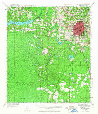
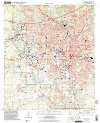
1960 Map of Tallahassee
USGS Topo · Published 1960About this map
Tallahassee stands as the inland focal point of this regional study, which bridges the panhandle of Florida and southwestern Georgia during the mid-century. The landscape is defined by the massive drainage systems of the Apalachicola and Ochlockonee rivers, feeding into the Gulf of Mexico. Along the coast, the Cold War military presence is prominent with Tyndall Air Force Base and the Mine Defense Laboratory (U.S. Navy) situated near Panama City. Significant conservation lands, including the Apalachicola National Forest and the St Marks National Wildlife Refuge, preserve the wetlands and timberlands that historically drove the local economy. Regional connectivity is illustrated by the Atlantic Coast Line and Louisville and Nashville railroads, which link interior agricultural hubs like Marianna, Bainbridge, and Thomasville to the coastal ports.
Find a feature on this map
41 named features on this map. Tap any name to fly to it.
Don’t see what you’re looking for? This feature index may not catch every label — zoom into the map to look around manually.
Map Details
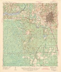
Editions of this 1960 Tallahassee Map
This is the sole edition of this map. No revisions or reprints were ever made.
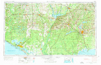
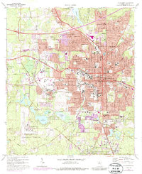
Historical Maps of Sweet Bay Through Time
11 maps found
1940 Tallahassee
Leon County, FL

1942 Tallahassee
Leon County, FL
1943 Tallahassee
Leon County, FL
1954 Tallahassee
Leon County, FL

1959 Tallahassee
Leon County, FL
1960 Tallahassee
Leon County, FL
1970 Tallahassee
Leon County, FL

1979 Tallahassee
Leon County, FL

1988 Tallahassee
Leon County, FL
1999 Tallahassee
Leon County, FL
2024 Tallahassee
Leon County, FL