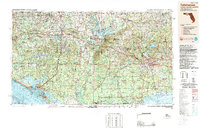
1988 Map of Tallahassee
USGS Topo · Published 1988About this map
The Apalachicola River serves as a dominant geographic divider on this 1980s map, separating the panhandle's pine forests from the capital city of Tallahassee. The region shows the maturity of the inland water systems following the creation of Lake Seminole at the confluence of the Flint River and Chattahoochee River. Coastal development is prominent near Panama City and Panama City Beach, while the eastern portion of the map is defined by the expansive Apalachicola National Forest and St Marks National Wildlife Refuge. Researchers can trace the mid-century industrial transport network, including the Seaboard System Railroad and Louisville & Nashville RR, alongside the modern development of Interstate 10, which connects the regional centers of Marianna, Quincy, and Tallahassee.
Find a feature on this map
89 named features on this map. Tap any name to fly to it.
Don’t see what you’re looking for? This feature index may not catch every label — zoom into the map to look around manually.
Map Details
Editions of this 1988 Tallahassee Map
2 editions found
Other maps of this area

1935 · De Funiak Springs
USGS Topo · 1:48,000

1936 · Point Washington
USGS Topo · 1:48,000

1938 · De Funiak Springs
USGS Topo · 1:62,500

1939 · Point Washington
USGS Topo · 1:62,500

1940 · Tallahassee
USGS Topo · 1:62,500

1940 · Arran
USGS Topo · 1:62,500

1942 · Enterprise
USGS Topo · 1:125,000

1942 · Tallahassee
USGS Topo · 1:62,500

1943 · Arran
USGS Topo · 1:62,500

1943 · Beacon Beach
USGS Topo · 1:31,680