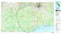
1979 Map of Tallahassee
USGS Topo · Published 1980About this map
The Florida state capital Tallahassee serves as the focal point of this late 1970s regional study, anchored by a network of waterways including the Ochlockonee River and St Marks River. To the south and west, the vast expanse of the Apalachicola National Forest dominates the landscape, punctuated by small settlements such as Hosford, Telogia, and Sopchoppy. The coastal margin reveals the ecologically diverse St Marks National Wildlife Refuge where the river meets Apalachee Bay, nearby the historic site of Port Leon.
Find a feature on this map
82 named features on this map. Tap any name to fly to it.
Don’t see what you’re looking for? This feature index may not catch every label — zoom into the map to look around manually.
Map Details
Editions of this 1979 Tallahassee Map
This is the sole edition of this map. No revisions or reprints were ever made.
Other maps of this area

1940 · Tallahassee
USGS Topo · 1:62,500

1940 · Arran
USGS Topo · 1:62,500

1942 · Tallahassee
USGS Topo · 1:62,500

1943 · Arran
USGS Topo · 1:62,500

1943 · Tallahassee
USGS Topo · 1:62,500

1943 · Lake Talquin
USGS Topo · 1:62,500

1943 · St. Teresa Beach
USGS Topo · 1:24,000

1943 · Lighthouse Point
USGS Topo · 1:24,000

1944 · Pickett Bay
USGS Topo · 1:31,680

1944 · Forbes Island
USGS Topo · 1:24,000