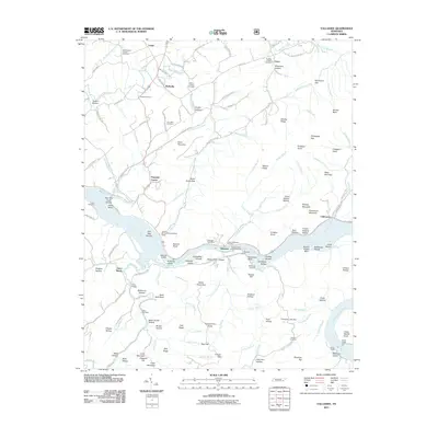
2011 Map of Tallassee
USGS Topo · Published 2011About this map
The Little Tennessee River defines the heart of this East Tennessee landscape, dominated by the massive Chilhowee Dam and its resulting reservoir. This 2011 survey captures the area as the Foothills Pkwy skirts the northern ridges of the Great Smoky Mountains foothills, connecting small rural centers like Lanier, Wellsville, and Pumpkin Center. The river corridor itself remains a focal point for local history and recreation, featuring the Tallassee Post Office, the Scona Lodge Ferry crossing, and several public access points like the Tallassee Boat Launching Ramp.
Find a feature on this map
143 named features on this map. Tap any name to fly to it.
Don’t see what you’re looking for? This feature index may not catch every label — zoom into the map to look around manually.
Map Details
Editions of this 2011 Tallassee Map
This is the sole edition of this map. No revisions or reprints were ever made.
Other maps of this area

1886 · Knoxville
USGS Topo · 1:125,000

1892 · Knoxville
USGS Topo · 1:125,000

1893 · Murphy
USGS Topo · 1:125,000

1894 · Knoxville
USGS Topo · 1:125,000

1895 · Loudon
USGS Topo · 1:125,000

1895 · Knoxville
USGS Topo · 1:125,000

1901 · Knoxville
USGS Topo · 1:125,000

1914 · Murphy
USGS Topo · 1:125,000

1933 · Haw Knob
USGS Topo · 1:48,000

1933 · Whiteoak Flats
USGS Topo · 1:24,000