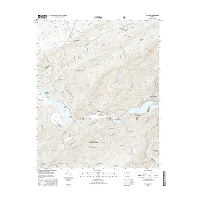
2016 Map of Tallassee
USGS Topo · Published 2016About this map
Tallassee and the Little Tennessee River corridor define this 2016 topographic study, where the river's expansion into Tellico Lake and Chilhowee Lake has fundamentally altered the East Tennessee landscape. The map captures a transition between the northern valley settlements of Wellsville and Lanier and the high ridges of Chilhowee Mountain. Evidence of early river crossings and historical transit remains in the naming of Fish Trap Shoals, Four Mile Creek Shoals, and the Babcock Trestle.
Find a feature on this map
93 named features on this map. Tap any name to fly to it.
Don’t see what you’re looking for? This feature index may not catch every label — zoom into the map to look around manually.
Map Details
Editions of this 2016 Tallassee Map
This is the sole edition of this map. No revisions or reprints were ever made.
Other maps of this area

1886 · Knoxville
USGS Topo · 1:125,000

1892 · Knoxville
USGS Topo · 1:125,000

1893 · Murphy
USGS Topo · 1:125,000

1894 · Knoxville
USGS Topo · 1:125,000

1895 · Loudon
USGS Topo · 1:125,000

1895 · Knoxville
USGS Topo · 1:125,000

1901 · Knoxville
USGS Topo · 1:125,000

1914 · Murphy
USGS Topo · 1:125,000

1933 · Haw Knob
USGS Topo · 1:48,000

1933 · Whiteoak Flats
USGS Topo · 1:24,000