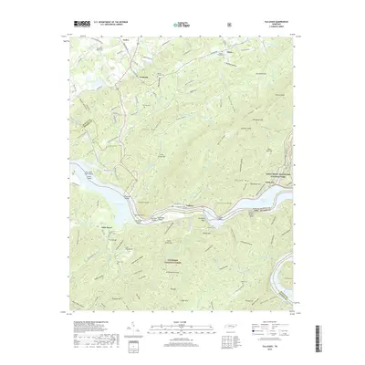
2019 Map of Tallassee
USGS Topo · Published 2019About this map
Tellico Lake and the winding course of the Little Tennessee River define the boundary between Blount and Monroe counties on this modern topographic survey. The landscape transitions from the developed corridors of Lanier and Wellsville in the north toward the protected slopes of the Cherokee National Forest and Great Smoky Mountains National Park. Several river shoals, including Fish Trap Shoals and Stratton Shoals, remain recorded alongside modern structures like the Babcock Trestle. For those looking into local lineage, the map identifies numerous family-named landmarks and historical sites, such as Williamsons Chapel Cem, Kagleys Chapel, and Keener Cem. The presence of Old Railroad Bed Rd suggests the path of vanished transport lines that once moved timber or goods through this mountain-and-valley corridor.
Find a feature on this map
145 named features on this map. Tap any name to fly to it.
Don’t see what you’re looking for? This feature index may not catch every label — zoom into the map to look around manually.
Map Details
Editions of this 2019 Tallassee Map
This is the sole edition of this map. No revisions or reprints were ever made.
Other maps of this area

1886 · Knoxville
USGS Topo · 1:125,000

1892 · Knoxville
USGS Topo · 1:125,000

1893 · Murphy
USGS Topo · 1:125,000

1894 · Knoxville
USGS Topo · 1:125,000

1895 · Loudon
USGS Topo · 1:125,000

1895 · Knoxville
USGS Topo · 1:125,000

1901 · Knoxville
USGS Topo · 1:125,000

1914 · Murphy
USGS Topo · 1:125,000

1933 · Haw Knob
USGS Topo · 1:48,000

1933 · Whiteoak Flats
USGS Topo · 1:24,000