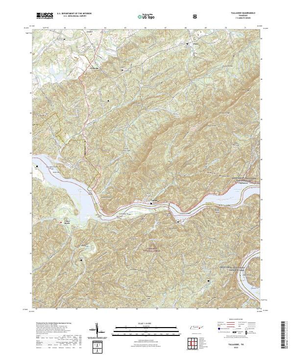
2022 Map of Tallassee
USGS Topo · Published 2022About this map
Chilhowee Mtn dominates the eastern landscape, serving as a natural boundary where the Cherokee National Forest and Great Smoky Mountains National Park converge. The Little Tennessee River flows through the center of the sheet, widening into Tellico Lake and creating a series of named shoals like Fish Trap Shoals and Stratton Shoals. These water features, alongside islands such as Harrison Island, define the low-lying areas between the high ridges of Shingle Mtn and Short Mtn.
Find a feature on this map
85 named features on this map. Tap any name to fly to it.
Don’t see what you’re looking for? This feature index may not catch every label — zoom into the map to look around manually.
Map Details
Editions of this 2022 Tallassee Map
This is the sole edition of this map. No revisions or reprints were ever made.
Other maps of this area

1886 · Knoxville
USGS Topo · 1:125,000

1892 · Knoxville
USGS Topo · 1:125,000

1893 · Murphy
USGS Topo · 1:125,000

1894 · Knoxville
USGS Topo · 1:125,000

1895 · Loudon
USGS Topo · 1:125,000

1895 · Knoxville
USGS Topo · 1:125,000

1901 · Knoxville
USGS Topo · 1:125,000

1914 · Murphy
USGS Topo · 1:125,000
1933 · Haw Knob
USGS Topo · 1:48,000
1933 · Whiteoak Flats
USGS Topo · 1:24,000