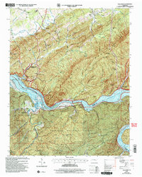
2003 Map of Tallassee
USGS Topo · Published 2004About this map
Chilhowee Dam controls the flow of the Little Tennessee River at the border of Blount and Monroe counties, anchoring a landscape shaped by hydroelectric development and forest preservation. The map reveals the early 21st-century extent of Tellico Lake and Chilhowee Lake, which submerged much of the historic river bottom land while preserving significant islands like Kirkland Island and Harrison Island.
Find a feature on this map
62 named features on this map. Tap any name to fly to it.
Don’t see what you’re looking for? This feature index may not catch every label — zoom into the map to look around manually.
Map Details
Editions of this 2003 Tallassee Map
This is the sole edition of this map. No revisions or reprints were ever made.
Other maps of this area

1886 · Knoxville
USGS Topo · 1:125,000

1892 · Knoxville
USGS Topo · 1:125,000

1893 · Murphy
USGS Topo · 1:125,000

1894 · Knoxville
USGS Topo · 1:125,000

1895 · Loudon
USGS Topo · 1:125,000

1895 · Knoxville
USGS Topo · 1:125,000

1901 · Knoxville
USGS Topo · 1:125,000

1914 · Murphy
USGS Topo · 1:125,000

1933 · Haw Knob
USGS Topo · 1:48,000

1933 · Whiteoak Flats
USGS Topo · 1:24,000