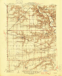
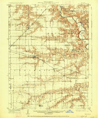
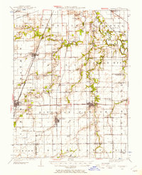
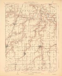
1909 Map of Tallula
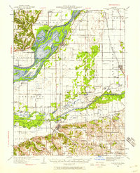
USGS Topo · Published 1946About this map
The Sangamon River meanders through the northeast corner of this central Illinois landscape, where it passes the grounds of Old Salem Chautauqua and New Salem State Park. The terrain is defined by a series of significant tributaries, including Rock Creek, Richland Creek, and Prairie Creek, which carve deep valleys into the surrounding prairie. This area, spanning portions of Menard, Sangamon, and Morgan counties, reveals a robust agricultural and transport network established by the mid-1940s. Four major rail lines, including the Chicago and Alton and the Baltimore and Ohio Southwestern, intersect the region, facilitating growth in settlements like Tallula and Pleasant Plains. The map identifies local landmarks such as Hilltop and Riddle Hill, alongside smaller community centers like Farmingdale and Berlin, providing a clear view of the rural township structure before mid-century modernization altered the smaller village footprints.
Find a feature on this map
33 named features on this map. Tap any name to fly to it.
Don’t see what you’re looking for? This feature index may not catch every label — zoom into the map to look around manually.
Map Details
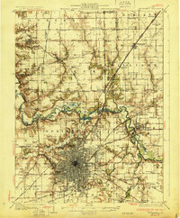
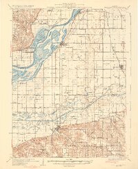
Editions of this 1909 Tallula Map
3 editions found
Other maps of this area

1907 · Springfield
USGS Topo · 1:62,500

1909 · Tallula
USGS Topo · 1:62,500
1922 · Divernon
USGS Topo · 1:62,500
1924 · Divernon
USGS Topo · 1:62,500

1924 · Waverly
USGS Topo · 1:62,500

1926 · Waverly
USGS Topo · 1:62,500
1930 · Chandlerville
USGS Topo · 1:62,500
1930 · Springfield
USGS Topo · 1:62,500
1932 · Chandlerville
USGS Topo · 1:62,500

1932 · Jacksonville
USGS Topo · 1:62,500