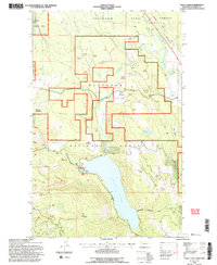
1994 Map of Tally Lake
USGS Topo · Published 1997About this map
Tally Lake dominates this 1994 Montana survey, bordered by the steep slopes of Tally Mountain and the deep cut of Stovepipe Canyon. This portion of the Flathead National Forest and the Stillwater State Forest reflects a landscape managed for both timber and recreation in the late twentieth century. In the northern reaches, the Stillwater River winds through the valley, flanked by the Burlington Northern railroad line. The map highlights a series of distinctive openings in the forest canopy, including Round Meadow, Hill Meadow, and Shorts Meadow, many of which were integrated into local infrastructure as evidenced by the Round Meadow Cross Country Ski Area. Water resources are prevalent throughout, from the Logan Creek drainage to smaller bodies like Chinook Lake and Fish Lake, with a dedicated Fishing Access point and Water Tank noted near the shore of Tally Lake.
Find a feature on this map
27 named features on this map. Tap any name to fly to it.
Don’t see what you’re looking for? This feature index may not catch every label — zoom into the map to look around manually.
Map Details
Editions of this 1994 Tally Lake Map
2 editions found
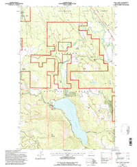
Other maps of this area

1906 · Kintla Lakes
USGS Topo · 1:125,000

1913 · Stryker
USGS Topo · 1:125,000

1916 · Stryker
USGS Topo · 1:125,000

1938 · Kintla Lakes
USGS Topo · 1:125,000

1943 · Kalispell
USGS Topo · 1:125,000

1957 · Kalispell
USGS Topo · 1:250,000

1960 · Kalispell
USGS Topo · 1:250,000

1961 · Kalispell
USGS Topo · 1:250,000

1962 · Johnson Peak
USGS Topo · 1:24,000

1962 · Beaver Lake
USGS Topo · 1:24,000