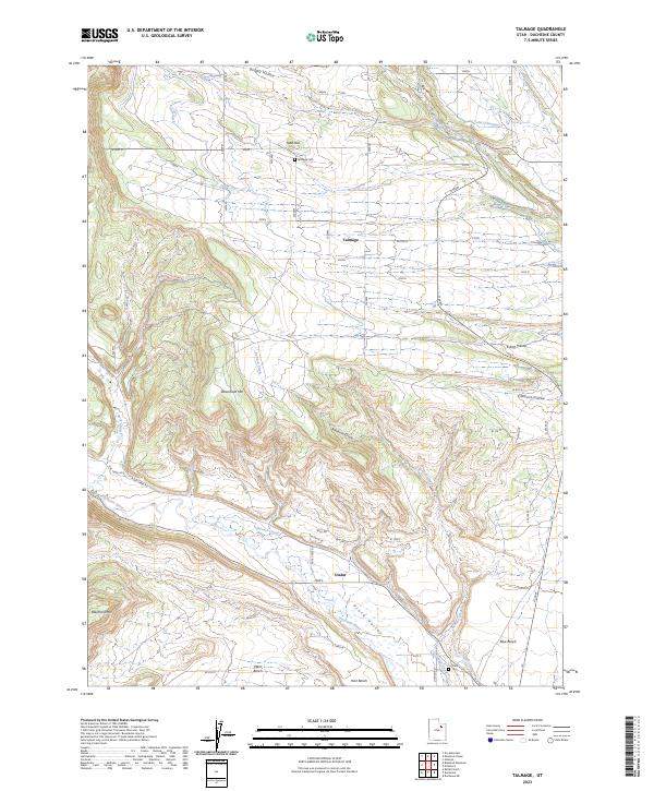
2023 Map of Talmage
USGS Topo · Published 2023About this map
Talmage and Utahn anchor this agricultural and high-desert landscape within the Uinta Valley. The irrigation network is the defining human footprint here, visible through the engineering of the Farnsworth Canal, Pioneer Canal, and Knight Ditch, which redirect water across the arid Blue Bench and Hair Bench. These water systems allowed for the establishment of small communities and their local landmarks, including the Talmage Cem and Utahn Cem. The terrain is characterized by dramatic elevation changes, rising from the Duchesne River bottomlands to prominent heights like Steamboat Mtn and Blacktail Mtn. Deep incisions like Benson Draw and Big Hollow cut through the benches, illustrating the complex drainage patterns of Pigeon Water Creek and Benson Creek as they move toward the river.
Find a feature on this map
27 named features on this map. Tap any name to fly to it.
Don’t see what you’re looking for? This feature index may not catch every label — zoom into the map to look around manually.
Map Details
Editions of this 2023 Talmage Map
This is the sole edition of this map. No revisions or reprints were ever made.
Other maps of this area

1885 · Uinta
USGS Topo · 1:250,000

1939 · Duchesne
USGS Topo · 1:125,000

1954 · Salt Lake City
USGS Topo · 1:250,000

1958 · Salt Lake City
USGS Topo · 1:250,000

1960 · Salt Lake City
USGS Topo · 1:250,000

1962 · Blacktail Mtn
USGS Topo · 1:24,000

1962 · Rabbit Gulch
USGS Topo · 1:24,000

1962 · Dry Mountain
USGS Topo · 1:24,000
1964 · Duchesne NE
USGS Topo · 1:24,000
1965 · Mountain Home
USGS Topo · 1:24,000