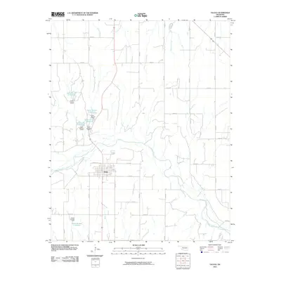
2010 Map of Taloga
USGS Topo · Published 2010About this map
Taloga serves as the central hub of this Oklahoma landscape, situated near a prominent bend in the Canadian River. The surrounding Dewey County terrain is defined by a grid-like network of rural section roads, including E 0680 RD and N 2270 RD, which weave through a series of significant water management features. A cluster of reservoirs named for local families—such as the Taylor Number 4 Reservoir, Taylor Number 3 Reservoir, and Taylor Number 10 Reservoir—illustrates the region's reliance on engineered water storage for agriculture and land management. Further south, the Kouns Number 1 Reservoir and its associated Kouns Number 1 Dam stand near the river's path. Small drainage systems like Seiling Creek and Cheyenne Creek feed into the river basin, marking the natural drainage patterns of this prairie environment as it appeared in the early 21st century.
Find a feature on this map
33 named features on this map. Tap any name to fly to it.
Don’t see what you’re looking for? This feature index may not catch every label — zoom into the map to look around manually.
Map Details
Editions of this 2010 Taloga Map
This is the sole edition of this map. No revisions or reprints were ever made.
Other maps of this area

1955 · Clinton
USGS Topo · 1:250,000

1955 · Woodward
USGS Topo · 1:250,000

1957 · Clinton
USGS Topo · 1:250,000

1958 · Woodward
USGS Topo · 1:250,000

1962 · Putnam
USGS Topo · 1:62,500

1962 · Aledo
USGS Topo · 1:62,500

1969 · Lenora
USGS Topo · 1:24,000

1969 · Mutual NE
USGS Topo · 1:24,000

1972 · Hucmac
USGS Topo · 1:24,000

1972 · Seiling
USGS Topo · 1:24,000