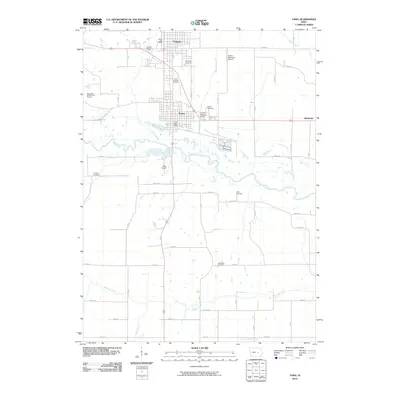
2010 Map of Tama
USGS Topo · Published 2010About this map
The adjacent communities of Toledo and Tama anchor this central Iowa landscape, where the built environment meets the winding course of the Iowa River. The region's deep cultural history is reflected in several significant sites, including the Mesquakie Indian Burial Grounds to the west and a high concentration of established burial sites such as Saint Patricks Cemetery and Woodlawn Cemetery. Transportation history is prominently marked by the Lincoln Highway Bridge crossing Tama-Mud Creek, a reminder of the nation's first transcontinental highway's path through the county.
Find a feature on this map
39 named features on this map. Tap any name to fly to it.
Don’t see what you’re looking for? This feature index may not catch every label — zoom into the map to look around manually.
Map Details
Editions of this 2010 Tama Map
This is the sole edition of this map. No revisions or reprints were ever made.
Other maps of this area

1954 · Waterloo
USGS Topo · 1:250,000

1954 · Des Moines
USGS Topo · 1:250,000

1955 · Waterloo
USGS Topo · 1:250,000

1956 · Des Moines
USGS Topo · 1:250,000

1957 · Des Moines
USGS Topo · 1:250,000

1968 · Belle Plaine SW
USGS Topo · 1:24,000

1968 · Chelsea
USGS Topo · 1:24,000

1969 · Des Moines
USGS Topo · 1:250,000
1971 · Clutier
USGS Topo · 1:24,000

1971 · Garwin
USGS Topo · 1:24,000