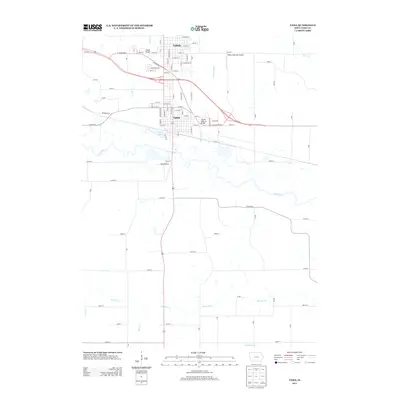
2013 Map of Tama
USGS Topo · Published 2013About this map
The adjacent cities of Toledo and Tama anchor this 2013 survey of the central Iowa landscape, separated only by the corridor of Highway 30. The geographic relationship between these two communities is defined by the Iowa River, which flows south of the urban centers. Historically significant infrastructure is evident here, notably the Lincoln Highway Bridge and the Toledo Bridge, which facilitate transport across the regional creek systems. The surrounding countryside is a dense grid of rural routes such as Meskwaki Rd and Co Hwy-E49, supporting an agricultural economy drained by numerous named waterways including Richland Cr and Deer Cr. Aviation history is marked by the presence of both the Toledo Municipal Airport and the smaller Tama Airport, while Cherry Lake provides a distinct hydrological landmark just south of the Tama city limits.
Find a feature on this map
87 named features on this map. Tap any name to fly to it.
Don’t see what you’re looking for? This feature index may not catch every label — zoom into the map to look around manually.
Map Details
Editions of this 2013 Tama Map
This is the sole edition of this map. No revisions or reprints were ever made.
Other maps of this area
1954 · Waterloo
USGS Topo · 1:250,000
1954 · Des Moines
USGS Topo · 1:250,000
1955 · Waterloo
USGS Topo · 1:250,000
1956 · Des Moines
USGS Topo · 1:250,000
1957 · Des Moines
USGS Topo · 1:250,000
1968 · Belle Plaine SW
USGS Topo · 1:24,000
1968 · Chelsea
USGS Topo · 1:24,000
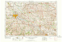
1969 · Des Moines
USGS Topo · 1:250,000
1971 · Clutier
USGS Topo · 1:24,000
1971 · Garwin
USGS Topo · 1:24,000