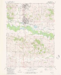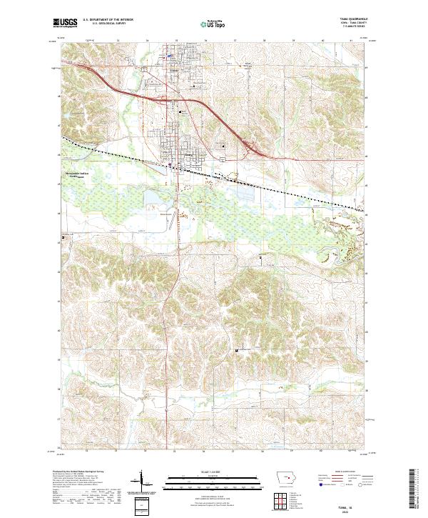
2022 Map of Tama
USGS Topo · Published 2022About this map
The Mesquakie Indian Settlement stands as a primary feature west of the Iowa River, bordering the adjacent municipal centers of Toledo and Tama. This landscape is defined by the sharp transition between the river's wide floodplains and the dissected uplands carved by Deer Cr, Richland Cr, and Otter Cr. In Toledo, the Tama County Courthouse serves as a central civic landmark, while the Tama-Toledo Rec Trl connects the two communities, illustrating modern recreational corridors alongside traditional agricultural and aviation sites like the Toledo Municipal Airport and Tama Airport. Local genealogy is well-documented through numerous burial grounds, including Saint Patricks Cem, Oak Hill Cem, and the more remote Croskrey Cem, which are scattered throughout the sections.
Find a feature on this map
43 named features on this map. Tap any name to fly to it.
Don’t see what you’re looking for? This feature index may not catch every label — zoom into the map to look around manually.
Map Details
Editions of this 2022 Tama Map
This is the sole edition of this map. No revisions or reprints were ever made.
Historical Maps of Tama Through Time
2 maps found