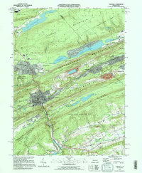
1995 Map of Tamaqua
USGS Topo · Published 1996About this map
The Tamaqua borough serves as the focal point of this mid-1990s survey, where the Little Schuylkill River and Panther Creek meet at the base of Sharp Mountain. This landscape is defined by the high ridges of the Anthracite Uplands, including Nesquehoning Mountain and Mauch Chunk Ridge, which hem in a dense corridor of mining and rail history. Evidence of the region's industrial heritage is everywhere, from the Strip Mine excavations near Coaldale to the Arlington Yards rail infrastructure.
Find a feature on this map
63 named features on this map. Tap any name to fly to it.
Don’t see what you’re looking for? This feature index may not catch every label — zoom into the map to look around manually.
Map Details
Editions of this 1995 Tamaqua Map
This is the sole edition of this map. No revisions or reprints were ever made.
Other maps of this area

1889 · Hazleton
USGS Topo · 1:62,500

1889 · Pottsville
USGS Topo · 1:62,500

1891 · Hazleton
USGS Topo · 1:62,500

1891 · Pottsville
USGS Topo · 1:62,500

1892 · Mahanoy
USGS Topo · 1:62,500

1893 · Hazleton
USGS Topo · 1:62,500

1893 · Mahanoy
USGS Topo · 1:62,500

1909 · Hamburg
USGS Topo · 1:62,500

1911 · Hamburg
USGS Topo · 1:62,500

1944 · Orwigsburg
USGS Topo · 1:24,000