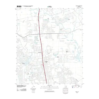
2010 Map of Tamina
USGS Topo · Published 2010About this map
The Woodlands and its neighboring communities are captured here in a period of intense suburban development along the Interstate 45 corridor. The landscape is a complex hybrid of modern planned residential expansion and older rural foundations, such as the Tamina Cemetery and the settlement of Tamina. The West Fork San Jacinto River winds through the northern portion of the quadrangle, flanked by numerous small lakes and reservoirs including Forrest Hills Lake and Shadow Lake, many held by named structures like the Shadow Lake Dam. In the southern reaches, the industrial legacy of the region is visible at the Rayford Oil Field, situated near the growing residential hubs of Rayford and Oak Ridge North. This 2010 survey illustrates the transition of Montgomery County from timber and oil production toward a dense network of master-planned communities and suburban infrastructure.
Find a feature on this map
83 named features on this map. Tap any name to fly to it.
Don’t see what you’re looking for? This feature index may not catch every label — zoom into the map to look around manually.
Map Details
Editions of this 2010 Tamina Map
This is the sole edition of this map. No revisions or reprints were ever made.
Other maps of this area

1916 · Louetta
USGS Topo · 1:24,000

1916 · Spring
USGS Topo · 1:24,000

1919 · Weeden
USGS Topo · 1:31,680

1920 · Spring
USGS Topo · 1:31,680

1920 · Louetta
USGS Topo · 1:31,680

1954 · Beaumont
USGS Topo · 1:250,000

1957 · Beaumont
USGS Topo · 1:250,000

1958 · Conroe
USGS Topo · 1:24,000

1958 · Cowl Spur
USGS Topo · 1:24,000

1959 · Outlaw Pond
USGS Topo · 1:24,000