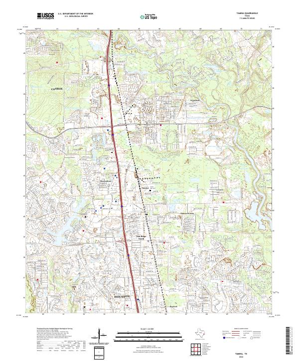
2022 Map of Tamina
USGS Topo · Published 2022About this map
The West Fork San Jacinto River carves a winding path through this portion of Montgomery County, defining a landscape where suburban expansion meets legacy rural settlements. This 2022 survey documents the density of modern development along the I-45 corridor, notably within Shenandoah and Oak Ridge North, while preserving the locations of several community landmarks. Genealogists can identify several local burial grounds, including the Sweet Rest Cem in the historic community of Tamina and the Wilburton Cem further south. The map also captures the educational and spiritual hubs of the area, such as Lone Star College - Montgomery and the Grace Garden Columbarium. Water features like Lake Harrison and Old Boggy Slough illustrate the complex drainage systems that characterize the region north of the Houston metropolitan boundary.
Find a feature on this map
261 named features on this map. Tap any name to fly to it.
Don’t see what you’re looking for? This feature index may not catch every label — zoom into the map to look around manually.
Map Details
Editions of this 2022 Tamina Map
This is the sole edition of this map. No revisions or reprints were ever made.
Other maps of this area

1916 · Louetta
USGS Topo · 1:24,000

1916 · Spring
USGS Topo · 1:24,000

1919 · Weeden
USGS Topo · 1:31,680

1920 · Spring
USGS Topo · 1:31,680

1920 · Louetta
USGS Topo · 1:31,680

1954 · Beaumont
USGS Topo · 1:250,000

1957 · Beaumont
USGS Topo · 1:250,000

1958 · Conroe
USGS Topo · 1:24,000

1958 · Cowl Spur
USGS Topo · 1:24,000

1959 · Outlaw Pond
USGS Topo · 1:24,000