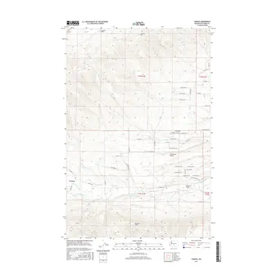
2017 Map of Tampico
USGS Topo · Published 2017About this map
Tampico and the Ahtanum Valley define this landscape west of Yakima, where the convergence of the N Fork Ahtanum Cr and S Fork Ahtanum Cr meet the rising slopes of Ahtanum Ridge. The area is characterized by a sophisticated network of water management features, including the John Cox Ditch, Shaw Knox Ditch, and Lesh Ditch, which support the valley floor between the high ground of Cowiche Mtn and Cottonwood Canyon. To the north, Cowiche Basin provides a natural northern boundary to the agricultural and residential development concentrated along Ahtanum Rd. Aviation history is noted by the presence of the West Valley Airport, situated near a series of residential corridors such as Songbird Rd and Quail Run Dr. The topography transitions from the structured irrigation of the valley to the more open, natural terrain of Oak Spring and Hatton Cr.
Find a feature on this map
57 named features on this map. Tap any name to fly to it.
Don’t see what you’re looking for? This feature index may not catch every label — zoom into the map to look around manually.
Map Details
Editions of this 2017 Tampico Map
This is the sole edition of this map. No revisions or reprints were ever made.
Other maps of this area

1899 · Ellensburg
USGS Topo · 1:125,000

1901 · Ellensburg
USGS Topo · 1:125,000

1937 · White Swan
USGS Topo · 1:125,000

1950 · Yakima
USGS Topo · 1:250,000

1957 · Yesmowit Canyon
USGS Topo · 1:24,000

1958 · Fort Simcoe
USGS Topo · 1:62,500

1958 · Wiley City
USGS Topo · 1:24,000

1958 · White Swan
USGS Topo · 1:24,000
1958 · Medicine Valley
USGS Topo · 1:24,000

1958 · Naches
USGS Topo · 1:24,000