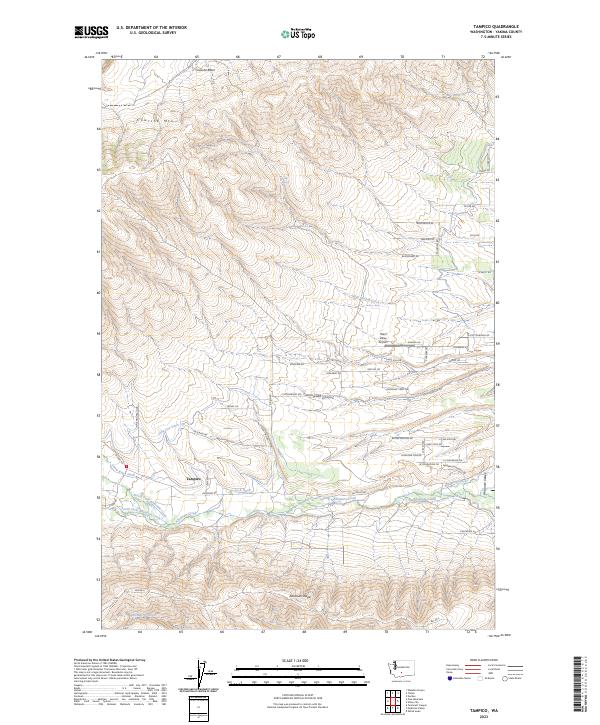
2023 Map of Tampico
USGS Topo · Published 2023About this map
Ahtanum Creek and its various forks and irrigation channels define the agricultural and geographic heart of this Yakima County landscape. The settlement of Tampico serves as a central point where the North Fork Ahtanum Creek and South Fork Ahtanum Creek converge, feeding into the Ahtanum Canal and supporting the Ahtanum Valley. The topography is marked by significant elevations, including Cowiche Mtn to the north and the prominent Ahtanum Ridge to the south.
Find a feature on this map
59 named features on this map. Tap any name to fly to it.
Don’t see what you’re looking for? This feature index may not catch every label — zoom into the map to look around manually.
Map Details
Editions of this 2023 Tampico Map
This is the sole edition of this map. No revisions or reprints were ever made.
Other maps of this area

1899 · Ellensburg
USGS Topo · 1:125,000

1901 · Ellensburg
USGS Topo · 1:125,000

1937 · White Swan
USGS Topo · 1:125,000

1950 · Yakima
USGS Topo · 1:250,000

1957 · Yesmowit Canyon
USGS Topo · 1:24,000

1958 · Fort Simcoe
USGS Topo · 1:62,500

1958 · Wiley City
USGS Topo · 1:24,000

1958 · White Swan
USGS Topo · 1:24,000
1958 · Medicine Valley
USGS Topo · 1:24,000

1958 · Naches
USGS Topo · 1:24,000