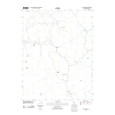
2012 Map of Tan Oak Park
USGS Topo · Published 2012About this map
Rattlesnake Cr defines the central corridor of this Mendocino County landscape, where the primary route winds past Tan Oak Park and ascends toward Rattlesnake Summit. The terrain is marked by remote ranching and specialized settlements, from Bald Mountain Ranch in the west to Redwine Ranch in the east. The geography of the early 21st century reveals a network of mountain roads such as Bell Springs Rd and Spyrock Rd that provide access to isolated points like Bowman Place and Camp Seabow.
Find a feature on this map
33 named features on this map. Tap any name to fly to it.
Don’t see what you’re looking for? This feature index may not catch every label — zoom into the map to look around manually.
Map Details
Editions of this 2012 Tan Oak Park Map
This is the sole edition of this map. No revisions or reprints were ever made.
Other maps of this area

1920 · Cummings
USGS Topo · 1:62,500

1920 · Covelo
USGS Topo · 1:62,500

1921 · Branscomb
USGS Topo · 1:62,500

1951 · Branscomb
USGS Topo · 1:62,500

1951 · Laytonville
USGS Topo · 1:62,500

1952 · Spyrock
USGS Topo · 1:62,500

1952 · Leggett
USGS Topo · 1:62,500

1957 · Ukiah
USGS Topo · 1:250,000

1960 · Ukiah
USGS Topo · 1:250,000
1966 · Lincoln Ridge
USGS Topo · 1:24,000