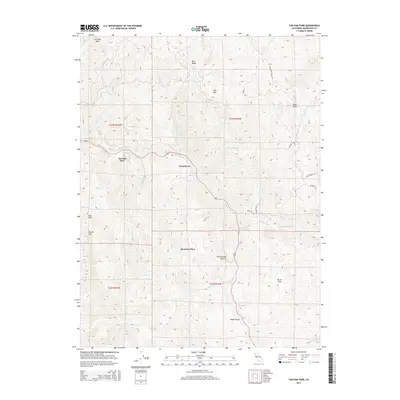
2015 Map of Tan Oak Park
USGS Topo · Published 2015About this map
Tan Oak Park serves as a central landmark in this portion of Mendocino County, where the terrain is defined by the high ridgelines of Mail Ridge and the prominent peaks of Cow Mtn and Bald Mtn. The landscape is carved by a dense network of drainage systems, most notably Rattlesnake Cr and Tenmile Cr, which dictate the local topography and the placement of small settlements and holdings like Bowman Place and Burns Flat.
Find a feature on this map
37 named features on this map. Tap any name to fly to it.
Don’t see what you’re looking for? This feature index may not catch every label — zoom into the map to look around manually.
Map Details
Editions of this 2015 Tan Oak Park Map
This is the sole edition of this map. No revisions or reprints were ever made.
Other maps of this area

1920 · Cummings
USGS Topo · 1:62,500

1920 · Covelo
USGS Topo · 1:62,500

1921 · Branscomb
USGS Topo · 1:62,500

1951 · Branscomb
USGS Topo · 1:62,500

1951 · Laytonville
USGS Topo · 1:62,500

1952 · Spyrock
USGS Topo · 1:62,500

1952 · Leggett
USGS Topo · 1:62,500

1957 · Ukiah
USGS Topo · 1:250,000

1960 · Ukiah
USGS Topo · 1:250,000
1966 · Lincoln Ridge
USGS Topo · 1:24,000