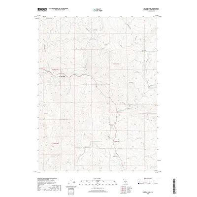
2018 Map of Tan Oak Park
USGS Topo · Published 2018About this map
Tan Oak Park sits at the heart of this Mendocino County landscape, where the headwaters of numerous creeks carve through a series of prominent ridges. The topography is defined by significant elevations such as Mail Ridge, Cow Mtn, and Rattlesnake Summit, which divide the drainages of Rattlesnake Cr and Tenmile Cr. This area represents a transition between high-elevation landmarks like Chimney Rock and Bald Mtn and the more sheltered valleys where small settlements like Steep Gulch and Burns Flat are situated.
Find a feature on this map
44 named features on this map. Tap any name to fly to it.
Don’t see what you’re looking for? This feature index may not catch every label — zoom into the map to look around manually.
Map Details
Editions of this 2018 Tan Oak Park Map
This is the sole edition of this map. No revisions or reprints were ever made.
Other maps of this area

1920 · Cummings
USGS Topo · 1:62,500

1920 · Covelo
USGS Topo · 1:62,500

1921 · Branscomb
USGS Topo · 1:62,500

1951 · Branscomb
USGS Topo · 1:62,500

1951 · Laytonville
USGS Topo · 1:62,500

1952 · Spyrock
USGS Topo · 1:62,500

1952 · Leggett
USGS Topo · 1:62,500

1957 · Ukiah
USGS Topo · 1:250,000

1960 · Ukiah
USGS Topo · 1:250,000
1966 · Lincoln Ridge
USGS Topo · 1:24,000