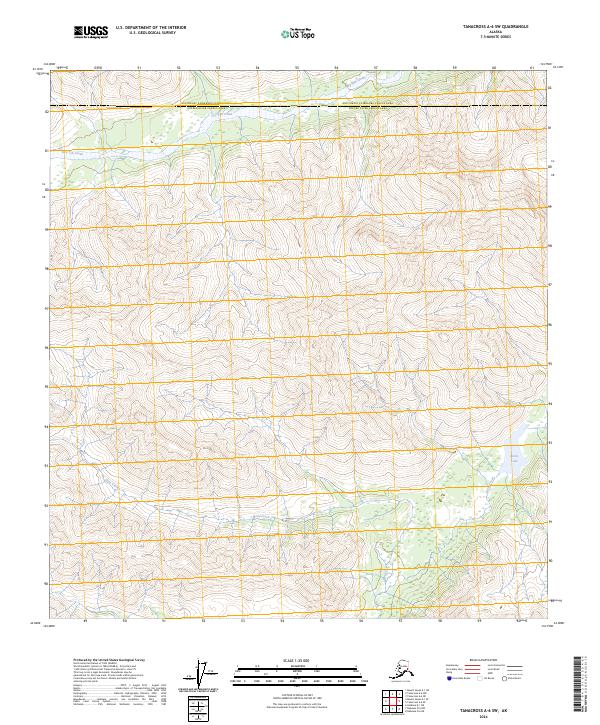
2024 Map of Tanacross A-6 SW
USGS Topo · Published 2024About this map
Dry Tok Creek flows across the northern reaches of this Alaskan interior landscape, where the administrative boundary between the Southeast Fairbanks Census Area and the Copper River Census Area intersects the terrain. The map captures a transition between high-elevation drainage patterns and the lower basin containing Burnt Lake. To the south, the headwaters of Bone Creek and Burnt Creek emerge from the steep contours, illustrating the primary watercourses that define the local geography. This 2024 survey documents the hydrography and elevation of a wilderness region where the lack of developed infrastructure emphasizes the natural flow of seasonal creeks and the permanence of remote alpine lakes.
Find a feature on this map
5 named features on this map. Tap any name to fly to it.
Don’t see what you’re looking for? This feature index may not catch every label — zoom into the map to look around manually.
Map Details
Editions of this 2024 Tanacross A-6 SW Map
This is the sole edition of this map. No revisions or reprints were ever made.
Other maps of this area

1948 · Tanacross A-6
USGS Topo · 1:63,360

1949 · Tanacross
USGS Topo · 1:250,000

1949 · Nabesna D-6
USGS Topo · 1:63,360

1949 · Mt. Hayes A-1
USGS Topo · 1:63,360

1950 · Tanacross
USGS Topo · 1:250,000

1950 · Nabesna
USGS Topo · 1:250,000

1950 · Mount Hayes
USGS Topo · 1:250,000

1951 · Gulkana
USGS Topo · 1:250,000

1951 · Mount Hayes
USGS Topo · 1:250,000

1951 · Nabesna
USGS Topo · 1:250,000