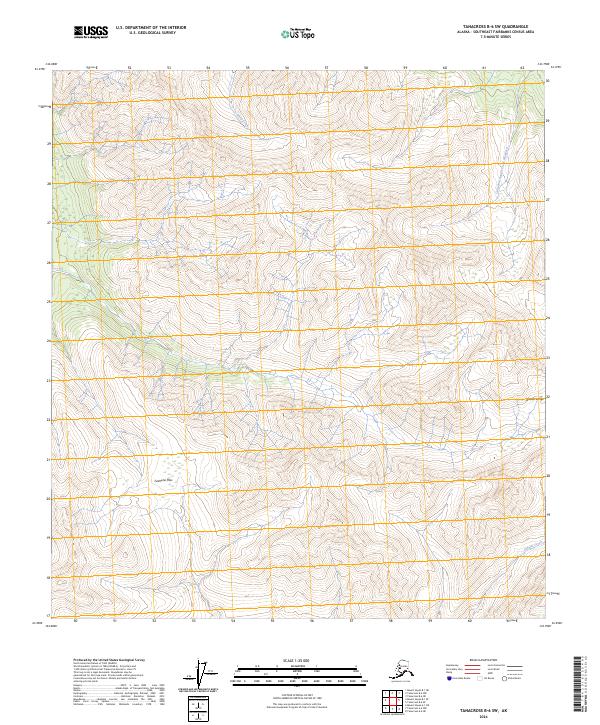
2024 Map of Tanacross B-6 SW
USGS Topo · Published 2024About this map
The Alaska Range defines the steep terrain of this interior quadrangle in the Southeast Fairbanks area. This high-altitude landscape is characterized by narrow drainage systems and high mountain passes, notably Tushtena Pass located in the southwestern portion of the sheet. The drainage pattern is defined by several prominent waterways including Sheep Creek in the north and the descriptively named Cathedral Rapids Creek Number 2 to the east. In the southeastern corner, Stibnite Creek flows through the township of T17N R9E, its name hinting at the mineral potential of the region. The map provides a high-resolution view of the topography and Public Land Survey System boundaries that organize this largely undeveloped wilderness area, illustrating the intersection of rugged Alaskan geography with the formal grid of the American West.
Find a feature on this map
11 named features on this map. Tap any name to fly to it.
Don’t see what you’re looking for? This feature index may not catch every label — zoom into the map to look around manually.
Map Details
Editions of this 2024 Tanacross B-6 SW Map
This is the sole edition of this map. No revisions or reprints were ever made.
Other maps of this area

1948 · Tanacross A-6
USGS Topo · 1:63,360

1949 · Tanacross
USGS Topo · 1:250,000

1949 · Tanacross B-6
USGS Topo · 1:63,360

1949 · Mt. Hayes A-1
USGS Topo · 1:63,360

1950 · Tanacross
USGS Topo · 1:250,000

1950 · Mount Hayes
USGS Topo · 1:250,000

1951 · Mount Hayes
USGS Topo · 1:250,000

1951 · Tanacross B-6
USGS Topo · 1:63,360
1952 · Tanacross A-6
USGS Topo · 1:63,360

1954 · Mount Hayes B-1
USGS Topo · 1:63,360