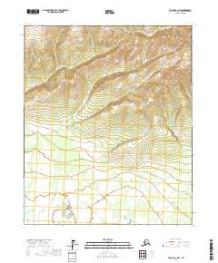
2017 Map of Tanana A-1 NW
USGS Topo · Published 2017About this map
Allen Cr and California Cr dominate the northern terrain of this Yukon-Koyukuk Census Area region, part of a dense hydrographic network defining the Interior Alaska landscape. This 2017 survey reveals a complex system of drainage basins where local naming conventions reflect the era of prospecting and early exploration, with tributaries such as New York Cr, Rhode Island Cr, and Chicago Cr feeding into the larger watersheds.
Find a feature on this map
18 named features on this map. Tap any name to fly to it.
Don’t see what you’re looking for? This feature index may not catch every label — zoom into the map to look around manually.
Map Details
Editions of this 2017 Tanana A-1 NW Map
This is the sole edition of this map. No revisions or reprints were ever made.
Other maps of this area

1951 · Tanana
USGS Topo · 1:250,000

1952 · Tanana A-1
USGS Topo · 1:63,360

1952 · Tanana A-2
USGS Topo · 1:63,360

1953 · Tanana A-2
USGS Topo · 1:63,360

1956 · Tanana B-1
USGS Topo · 1:63,360

1956 · Tanana B-2
USGS Topo · 1:63,360

1956 · Tanana
USGS Topo · 1:250,000

1960 · Tanana
USGS Topo · 1:250,000
2017 · Tanana A-1 SE
USGS Topo · 1:25,000
2017 · Tanana B-2 SE
USGS Topo · 1:25,000