
1956 Map of Tanana B-1
USGS Topo · Published 1959About this map
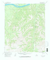
The Yukon River defines the northern reaches of this Alaskan interior terrain, where gold-bearing geography is evident in the numerous named river bars. Locations like Yukon Bar, Idaho Bar, California Bar, and Mc Donald Bar suggest a history of prospecting along the riverbanks and the drainage of Minook Creek. In the rugged high country to the south, prominent peaks such as Baldy Mountain and Elephant Mountain rise above a dense network of creek systems. Small signs of human presence are limited to isolated Cabin sites and the Fraser Mine near the headwaters of Hunter Creek. This mid-century survey, compiled from aerial photography, captures the area during the tenure of the VABM 1956 Rampart triangulation station, documenting a landscape primarily shaped by the mining and trapping activities of the Yukon-Koyukuk region.
Find a feature on this map
41 named features on this map. Tap any name to fly to it.
Don’t see what you’re looking for? This feature index may not catch every label — zoom into the map to look around manually.
Map Details
Editions of this 1956 Tanana B-1 Map
3 editions found
Other maps of this area

1945 · Livengood
USGS Topo · 1:250,000

1951 · Tanana
USGS Topo · 1:250,000

1951 · Livengood
USGS Topo · 1:250,000

1952 · Tanana A-1
USGS Topo · 1:63,360

1952 · Livengood A-6
USGS Topo · 1:63,360

1952 · Tanana A-2
USGS Topo · 1:63,360

1953 · Livengood A-6
USGS Topo · 1:63,360

1953 · Tanana A-2
USGS Topo · 1:63,360

1956 · Tanana C-1
USGS Topo · 1:63,360

1956 · Livengood B-6
USGS Topo · 1:63,360