
1956 Map of Tanana C-1
USGS Topo · Published 1959About this map
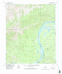
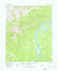
Rampart sits along the southern bank of the Yukon River in this 1950s study of the Alaska interior. The settlement is centered near the mouth of Minook Creek, where a cluster of vital infrastructure includes a Cem, an Airstrip, and a Gaging Sta. The landscape reveals a transition from the river's floodplains to higher elevations, evidenced by the defunct Agricultural Sta (Aband) and several scattered Cabins that hint at seasonal subsistence or early homesteading efforts. To the west, the terrain rises sharply toward Squaw Creek, while the river itself bends north toward the curiously named Point No-Point. Large marshy basins like the Chicago Lakes dominate the eastern reaches, illustrating the complex drainage patterns of this subarctic wilderness before major modern developments altered the remote landscape.
Find a feature on this map
23 named features on this map. Tap any name to fly to it.
Don’t see what you’re looking for? This feature index may not catch every label — zoom into the map to look around manually.
Map Details
Editions of this 1956 Tanana C-1 Map
3 editions found
Other maps of this area

1945 · Livengood
USGS Topo · 1:250,000

1951 · Tanana
USGS Topo · 1:250,000

1951 · Livengood
USGS Topo · 1:250,000

1956 · Tanana B-1
USGS Topo · 1:63,360

1956 · Livengood B-6
USGS Topo · 1:63,360

1956 · Livengood C-6
USGS Topo · 1:63,360

1956 · Livengood D-6
USGS Topo · 1:63,360

1956 · Tanana D-2
USGS Topo · 1:63,360

1956 · Tanana B-2
USGS Topo · 1:63,360

1956 · Tanana C-2
USGS Topo · 1:63,360