
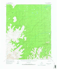
1956 Map of Tanana D-2
USGS Topo · Published 1960About this map
Ray River Hot Spring stands as a notable geological landmark in this mid-century interior Alaskan landscape, situated along the winding course of the Ray River. The terrain is defined by a series of drainage systems, including the aptly named Asbestos Creek and the southern reaches of Dreamland Creek. The presence of the hot spring suggests a unique geothermal signature within this subarctic environment, long before modern infrastructure reached the area.
Find a feature on this map
7 named features on this map. Tap any name to fly to it.
Don’t see what you’re looking for? This feature index may not catch every label — zoom into the map to look around manually.
Map Details
Editions of this 1956 Tanana D-2 Map
2 editions found
Other maps of this area

1951 · Bettles
USGS Topo · 1:250,000

1951 · Tanana
USGS Topo · 1:250,000

1956 · Bettles
USGS Topo · 1:250,000

1956 · Tanana C-1
USGS Topo · 1:63,360

1956 · Tanana D-3
USGS Topo · 1:63,360

1956 · Tanana C-3
USGS Topo · 1:63,360

1956 · Tanana C-2
USGS Topo · 1:63,360

1956 · Tanana D-1
USGS Topo · 1:63,360

1956 · Tanana
USGS Topo · 1:250,000

1960 · Tanana
USGS Topo · 1:250,000