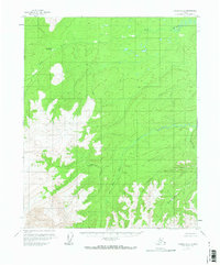
1956 Map of Tanana D-2
USGS Topo · Published 1972About this map
Ray River Hot Spring stands as a notable landmark in this interior Alaskan wilderness, situated along the upper reaches of the Ray River. Surveyed in the mid-1950s, the landscape is defined by a complex drainage system where the Big Salt River and several smaller tributaries carve through the terrain. The presence of the hot spring suggests a unique geothermal pocket within this otherwise remote northern environment. Names like Dreamland Creek, Asbestos Creek, and Hala Creek hint at the interests of early explorers and prospectors who moved through these unsurveyed lands. The map reflects a moment before significant modern development, showing a territory where natural watercourses and topography remained the primary guides for travel.
Find a feature on this map
6 named features on this map. Tap any name to fly to it.
Don’t see what you’re looking for? This feature index may not catch every label — zoom into the map to look around manually.
Map Details
Editions of this 1956 Tanana D-2 Map
2 editions found
Other maps of this area

1951 · Bettles
USGS Topo · 1:250,000

1951 · Tanana
USGS Topo · 1:250,000

1956 · Bettles
USGS Topo · 1:250,000

1956 · Tanana C-1
USGS Topo · 1:63,360

1956 · Tanana D-2
USGS Topo · 1:63,360

1956 · Tanana D-3
USGS Topo · 1:63,360

1956 · Tanana C-3
USGS Topo · 1:63,360

1956 · Tanana C-2
USGS Topo · 1:63,360

1956 · Tanana D-1
USGS Topo · 1:63,360

1956 · Tanana
USGS Topo · 1:250,000