
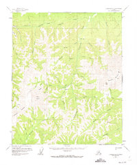
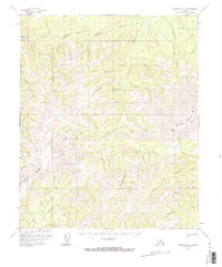
1956 Map of Livengood B-6
USGS Topo · Published 1959About this map
Wolverine Mountain and Elephant Mountain anchor this interior Alaskan landscape, which was captured through aerial photogrammetry during the mid-1950s. The region is defined by a dense network of drainages and high ridges, where small-scale mining operations left their mark on the wilderness. Gold-seeking activity is evident along the waterways, with a Placer Mine and several Mine and Prospect sites located near Quail Creek and Troublesome Creek.
Find a feature on this map
41 named features on this map. Tap any name to fly to it.
Don’t see what you’re looking for? This feature index may not catch every label — zoom into the map to look around manually.
Map Details
Editions of this 1956 Livengood B-6 Map
3 editions found
Other maps of this area

1945 · Livengood
USGS Topo · 1:250,000

1951 · Tanana
USGS Topo · 1:250,000

1951 · Livengood
USGS Topo · 1:250,000

1951 · Livengood A-5
USGS Topo · 1:63,360

1952 · Tanana A-1
USGS Topo · 1:63,360

1952 · Livengood A-6
USGS Topo · 1:63,360

1952 · Livengood C-5
USGS Topo · 1:63,360

1952 · Livengood B-5
USGS Topo · 1:63,360

1953 · Livengood A-6
USGS Topo · 1:63,360
1954 · Livengood A-5
USGS Topo · 1:63,360