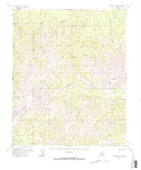
1956 Map of Livengood B-6
USGS Topo · Published 1973About this map
Gold mining operations and the drainage network of the Yukon-Koyukuk region define this mid-century landscape. The area around Hunter Placer Mine and the nearby Idaho Bar shows the footprint of resource extraction along the creeks. Engineering for water management is evident in the Ditch system winding through the center of the sheet, designed to support mining sites like those found near Quail Creek. The topography is anchored by the heights of Wolverine Mountain and Sawtooth Mountain, while smaller tributaries like Eldorado Pup and Thirteen Pup suggest the localized nature of early prospecting.
Find a feature on this map
47 named features on this map. Tap any name to fly to it.
Don’t see what you’re looking for? This feature index may not catch every label — zoom into the map to look around manually.
Map Details
Editions of this 1956 Livengood B-6 Map
3 editions found

Other maps of this area

1945 · Livengood
USGS Topo · 1:250,000

1951 · Tanana
USGS Topo · 1:250,000

1951 · Livengood
USGS Topo · 1:250,000

1951 · Livengood A-5
USGS Topo · 1:63,360

1952 · Tanana A-1
USGS Topo · 1:63,360

1952 · Livengood A-6
USGS Topo · 1:63,360

1952 · Livengood C-5
USGS Topo · 1:63,360

1952 · Livengood B-5
USGS Topo · 1:63,360

1953 · Livengood A-6
USGS Topo · 1:63,360
1954 · Livengood A-5
USGS Topo · 1:63,360