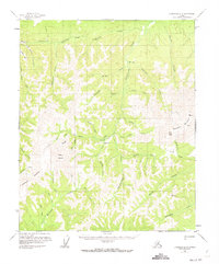
1956 Map of Livengood B-6
USGS Topo · Published 1973About this map
Hunter stands as a primary settlement point in this interior Alaskan wilderness, situated where Hunter Creek and Dawson Creek converge. The landscape is defined by its gold-mining legacy, evidenced by several Placer Mines and the presence of Idaho Bar along Little Minook Creek. Resource extraction and transport in this roadless region relied on a network of waterways and a notable Ditch line, reflecting the complex infrastructure required for hydraulic mining operations during the mid-20th century.
Find a feature on this map
53 named features on this map. Tap any name to fly to it.
Don’t see what you’re looking for? This feature index may not catch every label — zoom into the map to look around manually.
Map Details
Editions of this 1956 Livengood B-6 Map
3 editions found

Other maps of this area

1945 · Livengood
USGS Topo · 1:250,000

1951 · Tanana
USGS Topo · 1:250,000

1951 · Livengood
USGS Topo · 1:250,000

1951 · Livengood A-5
USGS Topo · 1:63,360

1952 · Tanana A-1
USGS Topo · 1:63,360

1952 · Livengood A-6
USGS Topo · 1:63,360

1952 · Livengood C-5
USGS Topo · 1:63,360

1952 · Livengood B-5
USGS Topo · 1:63,360

1953 · Livengood A-6
USGS Topo · 1:63,360
1954 · Livengood A-5
USGS Topo · 1:63,360