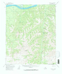
1956 Map of Tanana B-1
USGS Topo · Published 1968About this map
The Yukon River carves through this northern landscape, revealing a mid-century interior defined by active prospecting and river-borne navigation. Remote Cabins and a Placer Mine near Hunter Creek indicate the persistent search for minerals along the river's gravel bars, including Idaho Bar, California Bar, and Mc Donald Bar. These named bars and the complex network of "pups" and creeks—such as Ten Pup and Little Minook Jr—highlight the granular detail recorded by field teams during the 1950s. High ground is anchored by Baldry Mountain and Elephant Mountain, while the drainage patterns of Minook Creek and Sixmile Creek suggest the challenging transport routes through the Yukon-Koyukuk region. This survey captures a specific era of Alaskan exploration before modern infrastructure altered the accessibility of these traditional mining and trapping grounds.
Find a feature on this map
42 named features on this map. Tap any name to fly to it.
Don’t see what you’re looking for? This feature index may not catch every label — zoom into the map to look around manually.
Map Details
Editions of this 1956 Tanana B-1 Map
3 editions found
Other maps of this area

1945 · Livengood
USGS Topo · 1:250,000

1951 · Tanana
USGS Topo · 1:250,000

1951 · Livengood
USGS Topo · 1:250,000

1952 · Tanana A-1
USGS Topo · 1:63,360

1952 · Livengood A-6
USGS Topo · 1:63,360

1952 · Tanana A-2
USGS Topo · 1:63,360

1953 · Livengood A-6
USGS Topo · 1:63,360

1953 · Tanana A-2
USGS Topo · 1:63,360

1956 · Tanana B-1
USGS Topo · 1:63,360

1956 · Tanana C-1
USGS Topo · 1:63,360