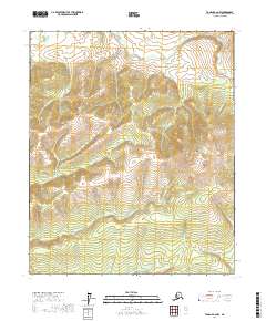
2017 Map of Tanana A-2 NW
USGS Topo · Published 2017About this map
Roughtop Mtn dominates the northeastern landscape of this interior Alaskan wilderness, serving as a primary high point in a region defined by complex ridge systems. The topographical structure is anchored by Boulder Ridge and the distinctively named Serpentine Ridge, which channel a dense network of seasonal and perennial streams. These drainage patterns, including Really Money Cr, Queen-Pawn Cr, and Little Boulder Cr, indicate a landscape shaped by persistent erosion and typical of the Yukon-Koyukuk mineral-rich corridors.
Find a feature on this map
22 named features on this map. Tap any name to fly to it.
Don’t see what you’re looking for? This feature index may not catch every label — zoom into the map to look around manually.
Map Details
Editions of this 2017 Tanana A-2 NW Map
This is the sole edition of this map. No revisions or reprints were ever made.
Other maps of this area

1951 · Tanana
USGS Topo · 1:250,000

1952 · Tanana A-3
USGS Topo · 1:63,360

1952 · Tanana A-2
USGS Topo · 1:63,360

1953 · Tanana A-2
USGS Topo · 1:63,360

1953 · Tanana A-3
USGS Topo · 1:63,360

1956 · Tanana B-2
USGS Topo · 1:63,360

1956 · Tanana B-3
USGS Topo · 1:63,360

1956 · Tanana
USGS Topo · 1:250,000

1960 · Tanana
USGS Topo · 1:250,000
2016 · Tanana A-3 SE
USGS Topo · 1:25,000