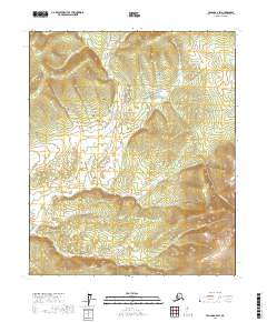
2017 Map of Tanana A-2 SW
USGS Topo · Published 2017About this map
Tofty stands as the primary geographic focal point in this 2017 survey of the Yukon-Koyukuk Census Area, situated amidst a complex network of placer gold-bearing drainages. The landscape is defined by its deep gulches and draws, many bearing the names of early prospectors and miners, including Miller Gulch, Innesvale Gulch, and Idaho Gulch. These features, along with Tofty Gulch, indicate a legacy of interior Alaskan mining activity concentrated near the southern slopes of Bean Ridge.
Find a feature on this map
27 named features on this map. Tap any name to fly to it.
Don’t see what you’re looking for? This feature index may not catch every label — zoom into the map to look around manually.
Map Details
Editions of this 2017 Tanana A-2 SW Map
This is the sole edition of this map. No revisions or reprints were ever made.
Other maps of this area

1948 · Kantishna River
USGS Topo · 1:250,000

1951 · Kantishna River
USGS Topo · 1:250,000

1951 · Tanana
USGS Topo · 1:250,000

1952 · Tanana A-3
USGS Topo · 1:63,360

1952 · Tanana A-2
USGS Topo · 1:63,360

1952 · Kantishna River
USGS Topo · 1:250,000

1952 · Kantishna River D-2
USGS Topo · 1:63,360

1952 · Kantishna River D-3
USGS Topo · 1:63,360

1953 · Tanana A-2
USGS Topo · 1:63,360

1953 · Tanana A-3
USGS Topo · 1:63,360