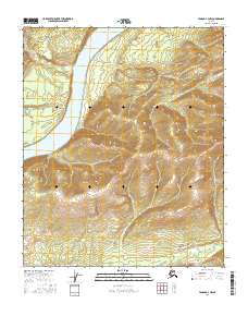
2016 Map of Tanana A-3 NW
USGS Topo · Published 2016About this map
The Yukon River dominates the northwestern portion of this terrain, winding past Point Tilman as it cuts through the Tanana region. This 2016 survey illustrates a largely unpopulated landscape defined by its complex drainage systems, where several significant tributaries converge or run parallel toward the main channel. To the west, Moose Lake sits near the riverbanks, while the eastern reaches are marked by the steep descents of Schieffelin Cr and Cheyenne Cr. The southeastern corner shows a high concentration of seasonal waterways, including Bailey Cr, Moose Cr, and Vatlee Cr, which flow into Boulder Cr. The absence of named settlements or roads highlights the isolation of this interior Alaska wilderness, preserved here through precise modern topographic data.
Find a feature on this map
13 named features on this map. Tap any name to fly to it.
Don’t see what you’re looking for? This feature index may not catch every label — zoom into the map to look around manually.
Map Details
Editions of this 2016 Tanana A-3 NW Map
This is the sole edition of this map. No revisions or reprints were ever made.
Other maps of this area

1951 · Tanana
USGS Topo · 1:250,000

1952 · Tanana A-3
USGS Topo · 1:63,360

1952 · Tanana A-4
USGS Topo · 1:63,360

1953 · Tanana A-3
USGS Topo · 1:63,360

1956 · Tanana B-3
USGS Topo · 1:63,360

1956 · Tanana B-4
USGS Topo · 1:63,360

1956 · Tanana
USGS Topo · 1:250,000

1960 · Tanana
USGS Topo · 1:250,000
2016 · Tanana B-4 SE
USGS Topo · 1:25,000
2016 · Tanana A-3 SE
USGS Topo · 1:25,000