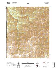
2017 Map of Tanana B-1 SW
USGS Topo · Published 2017About this map
Baldry Mtn stands as the central topographic focal point in this remote Alaskan wilderness within the Yukon-Koyukuk Census Area. The landscape is defined by an intricate network of drainage basins, where the headwaters of Garnet Cr and Rock Cr carve through the high elevations. This 2017 survey reflects the enduring, undeveloped character of the interior, showing a terrain devoid of modern infrastructure and dominated instead by the natural flow of waterways like Ruby Cr and Slate Cr. The map provides a detailed record of the land's contours as they transition from the peaks down to the valleys of Boulder Cr and Granite Cr, offering a precise view of the geographic isolation and hydrological patterns that characterize this portion of the Tanana region.
Find a feature on this map
11 named features on this map. Tap any name to fly to it.
Don’t see what you’re looking for? This feature index may not catch every label — zoom into the map to look around manually.
Map Details
Editions of this 2017 Tanana B-1 SW Map
This is the sole edition of this map. No revisions or reprints were ever made.
Other maps of this area

1951 · Tanana
USGS Topo · 1:250,000

1952 · Tanana A-1
USGS Topo · 1:63,360

1952 · Tanana A-2
USGS Topo · 1:63,360

1953 · Tanana A-2
USGS Topo · 1:63,360

1956 · Tanana B-1
USGS Topo · 1:63,360

1956 · Tanana B-2
USGS Topo · 1:63,360

1956 · Tanana
USGS Topo · 1:250,000

1960 · Tanana
USGS Topo · 1:250,000
2017 · Tanana B-1 NW
USGS Topo · 1:25,000
2017 · Tanana B-2 SE
USGS Topo · 1:25,000