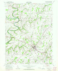
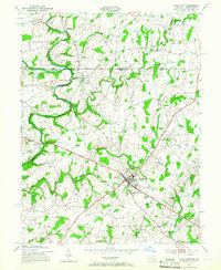
1953 Map of Taneytown
USGS Topo · Published 1972About this map
The Mason and Dixon Line separates Pennsylvania and Maryland across the upper third of this landscape, where the historic crossroads of Taneytown serves as a primary hub for commerce and transportation in Carroll County. This area displays a complex network of colonial-era boundaries and small rural settlements like Harney, Longville, and Bridgeport. The terrain is shaped by the winding course of the Monocacy River and the branching waters of Piney Creek and Big Pipe Creek. Local community life is anchored by institutions such as Taneytown School, St James Church, and the Hoffman Orphanage. Industrial and recreational footprints are evident at Mairs Mill and Memorial Park, while the Penn Central tracks facilitate regional transit through the heart of the town, connecting the small outlying hamlets of Stumptown and Copperville to the broader agricultural landscape.
Find a feature on this map
33 named features on this map. Tap any name to fly to it.
Don’t see what you’re looking for? This feature index may not catch every label — zoom into the map to look around manually.
Map Details
Editions of this 1953 Taneytown Map
5 editions found
Other maps of this area

1908 · Gettysburg
USGS Topo · 1:62,500

1909 · Fairfield
USGS Topo · 1:62,500

1911 · Taneytown
USGS Topo · 1:62,500

1911 · Emmitsburg
USGS Topo · 1:62,500

1942 · Gettysburg
USGS Topo · 1:125,000

1943 · Emmitsburg
USGS Topo · 1:62,500

1944 · Union Bridge
USGS Topo · 1:31,680

1944 · Gettysburg
USGS Topo · 1:31,680

1944 · New Windsor
USGS Topo · 1:31,680

1944 · Mc Sherrystown
USGS Topo · 1:31,680