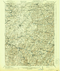
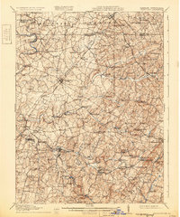
1911 Map of Taneytown
USGS Topo · Published 1944About this map
Taneytown serves as the central hub for this early twentieth-century landscape, which spans the border between Carroll Co and Frederick Co, Maryland, and Adams Co, Pennsylvania. The region is defined by a dense network of water-powered industry and rural education, with numerous grist and saw mills such as Markers Mill, Arters Mill, and Hahns Mill lining the banks of Big Pipe Creek and Silver Run. This industrial distribution suggests a highly localized economy reliant on the many branches of the Monocacy River.
Find a feature on this map
110 named features on this map. Tap any name to fly to it.
Don’t see what you’re looking for? This feature index may not catch every label — zoom into the map to look around manually.
Map Details
Editions of this 1911 Taneytown Map
6 editions found

Other maps of this area

1892 · Ellicott
USGS Topo · 1:62,500

1893 · Frederick
USGS Topo · 1:125,000

1894 · Ellicott
USGS Topo · 1:62,500

1894 · Frederick
USGS Topo · 1:125,000

1905 · Westminster
USGS Topo · 1:62,500

1906 · Ellicott
USGS Topo · 1:62,500

1908 · Patapsco
USGS Topo · 1:125,000

1908 · Gettysburg
USGS Topo · 1:62,500

1908 · Ijamsville
USGS Topo · 1:62,500

1909 · Mount Airy
USGS Topo · 1:62,500