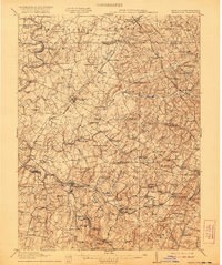
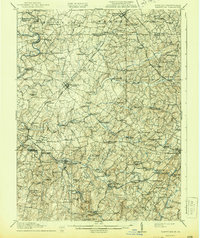
1911 Map of Taneytown
USGS Topo · Published 1921About this map
Taneytown stands as a central hub in this early twentieth-century survey of the Maryland-Pennsylvania borderlands. The landscape is defined by the intricate drainages of the Monocacy River, Big Pipe Creek, and Little Pipe Creek, which powered a dense network of local industry, including Markers Mill, Anders Mill, and Hahns Mill. The region's social fabric is visible through its numerous rural institutions, from New Windsor College to isolated houses of worship like Stone Chapel and Piney Creek Church.
Find a feature on this map
106 named features on this map. Tap any name to fly to it.
Don’t see what you’re looking for? This feature index may not catch every label — zoom into the map to look around manually.
Map Details
Editions of this 1911 Taneytown Map
6 editions found

Other maps of this area

1892 · Ellicott
USGS Topo · 1:62,500

1893 · Frederick
USGS Topo · 1:125,000

1894 · Ellicott
USGS Topo · 1:62,500

1894 · Frederick
USGS Topo · 1:125,000

1905 · Westminster
USGS Topo · 1:62,500

1906 · Ellicott
USGS Topo · 1:62,500

1908 · Patapsco
USGS Topo · 1:125,000

1908 · Gettysburg
USGS Topo · 1:62,500

1908 · Ijamsville
USGS Topo · 1:62,500

1909 · Mount Airy
USGS Topo · 1:62,500