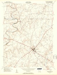
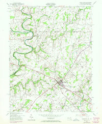
1953 Map of Taneytown
USGS Topo · Published 1955About this map
The Mason And Dixon Line bisects this landscape, marking the historic boundary between Maryland and Pennsylvania. Centered on the town of Taneytown, the map reveals a mid-century community defined by its agricultural roots and early industrial infrastructure. Near the northern border, Harney sits just below the state line, while Mairs Mill and Sterners Dam along the Monocacy River indicate the importance of water power to the local economy.
Find a feature on this map
44 named features on this map. Tap any name to fly to it.
Don’t see what you’re looking for? This feature index may not catch every label — zoom into the map to look around manually.
Map Details
Editions of this 1953 Taneytown Map
5 editions found
Other maps of this area

1908 · Gettysburg
USGS Topo · 1:62,500

1909 · Fairfield
USGS Topo · 1:62,500

1911 · Taneytown
USGS Topo · 1:62,500

1911 · Emmitsburg
USGS Topo · 1:62,500

1942 · Gettysburg
USGS Topo · 1:125,000

1943 · Emmitsburg
USGS Topo · 1:62,500

1944 · Union Bridge
USGS Topo · 1:31,680

1944 · Gettysburg
USGS Topo · 1:31,680

1944 · New Windsor
USGS Topo · 1:31,680

1944 · Mc Sherrystown
USGS Topo · 1:31,680