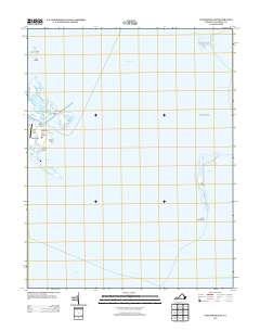
2013 Map of Tangier Island
USGS Topo · Published 2013About this map
Tangier island and its surrounding archipelago define this maritime landscape in the middle of Tangier Sound. The isolated settlement is organized along distinct elevated lands including Main Ridge, West Ridge, and Canton Ridge, separated by a complex network of tidal waterways like Toms Gut and Fishing Gut. This geography highlights the community's total dependence on the water, with critical infrastructure like Mailboat Harbor and the Tangier Island Airport providing the only links to the mainland.
Find a feature on this map
26 named features on this map. Tap any name to fly to it.
Don’t see what you’re looking for? This feature index may not catch every label — zoom into the map to look around manually.
Map Details
Editions of this 2013 Tangier Island Map
This is the sole edition of this map. No revisions or reprints were ever made.
Other maps of this area

1903 · Crisfield
USGS Topo · 1:62,500

1917 · Ewell
USGS Topo · 1:62,500

1920 · Crisfield
USGS Topo · 1:62,500

1942 · Chesconessex
USGS Topo · 1:31,680

1942 · Nandua Creek
USGS Topo · 1:24,000

1942 · Ewell
USGS Topo · 1:24,000

1942 · Great Fox Island
USGS Topo · 1:24,000

1942 · Tangier Island
USGS Topo · 1:24,000
1943 · Ewell
USGS Topo · 1:31,680

1943 · Pungoteague
USGS Topo · 1:31,680