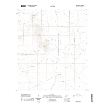
2020 Map of Tank Mountain
USGS Topo · Published 2020About this map
Jim Robinson marks a primary point of human settlement in this high-desert landscape of Hidalgo County, situated near the head of Animas Cr. The terrain is defined by volcanic prominences including Tank Mtn, Little Tank Mtn, and Red Hill, which rise above the surrounding flats. These peaks provide the watershed for numerous seasonal drainages such as Big Cr, Whitmire Cr, and the winding Cabin Canyon.
Find a feature on this map
48 named features on this map. Tap any name to fly to it.
Don’t see what you’re looking for? This feature index may not catch every label — zoom into the map to look around manually.
Map Details
Editions of this 2020 Tank Mountain Map
This is the sole edition of this map. No revisions or reprints were ever made.
Other maps of this area

1918 · Walnut Wells
USGS Topo · 1:62,500

1918 · Playas
USGS Topo · 1:62,500

1918 · Animas Peak
USGS Topo · 1:62,500

1918 · Pratt
USGS Topo · 1:62,500

1919 · Pratt
USGS Topo · 1:62,500

1919 · Playas
USGS Topo · 1:62,500

1920 · Animas Peak
USGS Topo · 1:62,500

1923 · Walnut Wells
USGS Topo · 1:62,500

1955 · Douglas
USGS Topo · 1:250,000

1959 · Douglas
USGS Topo · 1:250,000