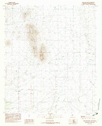
1982 Map of Tank Mountain
USGS Topo · Published 1982About this map
Tank Mountain and the adjacent Little Tank Mountain define the high ground of this southwestern New Mexico landscape, which was documented in the late 1970s and early 1980s. The region is characterized by a network of drainage systems including Animas Creek, Big Creek, and the South Fork, which carve through the arid terrain. The presence of water infrastructure such as XT Tank and Santa Rita Tank points to the area's utility for livestock and ranching, where reliable water sources were essential for survival. Named landmarks like Red Hill and Cabin Canyon provide fixed points for navigation across the open range. This document captures the hydrologic and topographic detail of Hidalgo County before more modern developments, showcasing a landscape where natural features and essential water tanks dictated the movement of people and animals.
Find a feature on this map
13 named features on this map. Tap any name to fly to it.
Don’t see what you’re looking for? This feature index may not catch every label — zoom into the map to look around manually.
Map Details
Editions of this 1982 Tank Mountain Map
This is the sole edition of this map. No revisions or reprints were ever made.
Other maps of this area

1918 · Walnut Wells
USGS Topo · 1:62,500

1918 · Playas
USGS Topo · 1:62,500

1918 · Animas Peak
USGS Topo · 1:62,500

1918 · Pratt
USGS Topo · 1:62,500

1919 · Pratt
USGS Topo · 1:62,500

1919 · Playas
USGS Topo · 1:62,500

1920 · Animas Peak
USGS Topo · 1:62,500

1923 · Walnut Wells
USGS Topo · 1:62,500

1955 · Douglas
USGS Topo · 1:250,000

1959 · Douglas
USGS Topo · 1:250,000