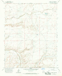
1966 Map of Tanner Lake
USGS Topo · Published 1969About this map
The high desert landscape of San Juan County is defined by the ephemeral waterways of the Chaco River and its numerous tributaries. This 1960s environment shows a stark network of washes and canyons, where vital water sources like Tsaya Spring and Dog Eye Pond stand out against the arid terrain. The map details a landscape transition from the lower De-na-zin Wash in the north toward the deeper incision of Tsaya Canyon in the south. Evidence of resource extraction or land management appears through scattered wells and mines, suggesting the localized industrial footprint in this corner of New Mexico. Named features such as Split Lip Flats and Tanner Lake provide specific geographic anchors for researchers studying the historical hydrology and land use patterns of the region before modern developments.
Find a feature on this map
12 named features on this map. Tap any name to fly to it.
Don’t see what you’re looking for? This feature index may not catch every label — zoom into the map to look around manually.
Map Details
Editions of this 1966 Tanner Lake Map
This is the sole edition of this map. No revisions or reprints were ever made.
Other maps of this area

1889 · Chaco
USGS Topo · 1:250,000

1892 · Chaco
USGS Topo · 1:250,000

1927 · Sulphur Spring
USGS Topo · 1:96,000

1928 · Kirtland
USGS Topo · 1:125,000

1932 · Kirtland
USGS Topo · 1:125,000

1954 · Shiprock
USGS Topo · 1:250,000

1958 · Shiprock
USGS Topo · 1:250,000

1959 · Shiprock
USGS Topo · 1:250,000
1966 · Alamo Mesa East
USGS Topo · 1:24,000
1966 · Alamo Mesa West
USGS Topo · 1:24,000