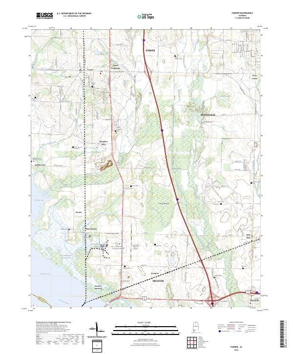
2024 Map of Tanner
USGS Topo · Published 2024About this map
The Tennessee River corridor south of Athens and Huntsville is defined by the intersection of industrial growth and expansive protected wetlands. This 2024 landscape shows the extensive reach of the Wheeler National Wildlife Refuge along the northern banks of Wheeler Lake, where the Harris-Sweetwater Dewatering Area manages the river's influence on the surrounding terrain.
Find a feature on this map
119 named features on this map. Tap any name to fly to it.
Don’t see what you’re looking for? This feature index may not catch every label — zoom into the map to look around manually.
Map Details
Editions of this 2024 Tanner Map
This is the sole edition of this map. No revisions or reprints were ever made.
Other maps of this area

1888 · Huntsville
USGS Topo · 1:125,000

1892 · Huntsville
USGS Topo · 1:125,000

1935 · Athens
USGS Topo · 1:24,000

1936 · Capshaw
USGS Topo · 1:24,000

1936 · Decatur
USGS Topo · 1:24,000

1936 · Stewart Cross Roads
USGS Topo · 1:24,000

1936 · Ripley
USGS Topo · 1:24,000

1936 · Trinity
USGS Topo · 1:24,000

1936 · Mason Ridge
USGS Topo · 1:24,000

1936 · Tanner
USGS Topo · 1:24,000