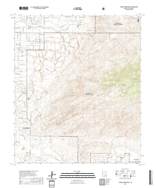
2021 Map of Tanque Verde Peak
USGS Topo · Published 2021About this map
Tanque Verde Peak anchors this corner of the Rincon Mountains, where the arid basin begins its sharp ascent into the high country. The landscape is defined by the transition from suburban development near Tucson and Twin Hills to the protected wilderness of Saguaro National Park and Coronado National Forest. Water management is central to life in this environment, evidenced by named features like Tanque Verde Wash, La Cebadilla Lake, and numerous livestock watering points such as Tina Larga Tank and Aguila Tank. Local history is preserved at the Tanque Verde Cem and Tanque Verde Ranch Cem. The survey meticulously details the ridge systems, including Tanque Verde Ridge, and deep cuts like Box Canyon and Wild Horse Canyon, reflecting the topographical complexity that has shaped the area's grazing and recreational history.
Find a feature on this map
117 named features on this map. Tap any name to fly to it.
Don’t see what you’re looking for? This feature index may not catch every label — zoom into the map to look around manually.
Map Details
Editions of this 2021 Tanque Verde Peak Map
This is the sole edition of this map. No revisions or reprints were ever made.
Other maps of this area

1904 · Tucson
USGS Topo · 1:125,000

1905 · Tucson
USGS Topo · 1:125,000

1948 · Tucson
USGS Topo · 1:62,500

1956 · Tucson
USGS Topo · 1:250,000

1957 · Tucson East
USGS Topo · 1:24,000

1957 · Bellota Ranch
USGS Topo · 1:62,500

1957 · Tucson
USGS Topo · 1:62,500

1957 · Rincon Valley
USGS Topo · 1:62,500

1957 · Sabino Canyon
USGS Topo · 1:24,000
1957 · Mount Lemmon
USGS Topo · 1:62,500