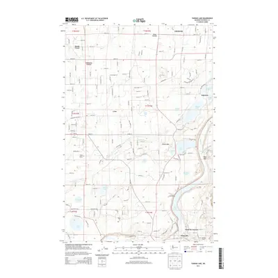
2013 Map of Tanwax Lake
USGS Topo · Published 2013About this map
Graham and its surrounding rural communities in Pierce County define this landscape, where the foothills meet a complex network of glacial lakes and creeks. The 2013 survey illustrates a transition from the structured residential grids of South Creek and Johnsons Corner in the north to the more secluded, water-oriented settlements like Kapowsin and Clear Lake. This area is characterized by its numerous small basins, including Tanwax Lake, Ohop Lake, and the tucked-away Benbow Lakes.
Find a feature on this map
92 named features on this map. Tap any name to fly to it.
Don’t see what you’re looking for? This feature index may not catch every label — zoom into the map to look around manually.
Map Details
Editions of this 2013 Tanwax Lake Map
This is the sole edition of this map. No revisions or reprints were ever made.
Other maps of this area

1897 · Tacoma
USGS Topo · 1:125,000

1900 · Tacoma
USGS Topo · 1:125,000

1937 · Eatonville
USGS Topo · 1:125,000

1941 · Tanwax Lake
USGS Topo · 1:62,500

1941 · Tacoma South
USGS Topo · 1:62,500

1942 · Lake Tapps
USGS Topo · 1:62,500

1944 · Lake Tapps
USGS Topo · 1:62,500

1944 · Tacoma South
USGS Topo · 1:62,500

1944 · Ohop Valley
USGS Topo · 1:62,500

1949 · Ohop Valley
USGS Topo · 1:62,500